History of Randolph County
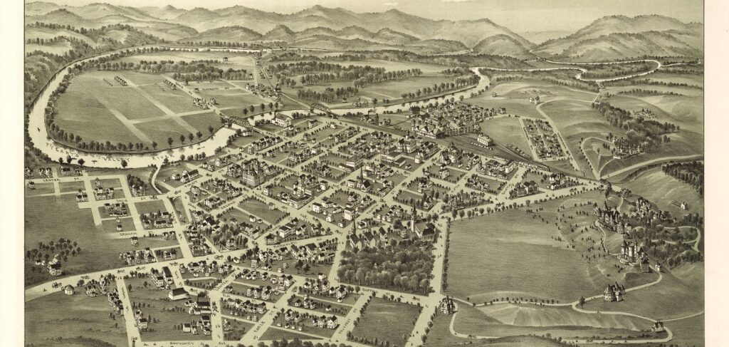
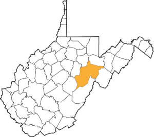 RANDOLPH COUNTY, WEST VIRGINIA
Randolph County, West Virginia the state’s largest county, was created by an act of the Virginia General Assembly in October 1786 from Harrison County. According to the first national census taken in 1790, Randolph County had the smallest population (951) of the nine counties that were then in existence and fell within the current boundaries of West Virginia.
Randolph County is located at the western edge of the Potomac Highlands in east-central West Virginia. Its high, forested mountains, many of which exceed 4,000 feet, lie at the headwaters of the Cheat, Tygart Valley, Elk, and Potomac rivers. The highest point in the county is in its extreme northeast corner on the Roaring Plains, a level area of land next to Dolly Sods, with an elevation of 4,782 feet. The lowest point is at 1,800 feet, at Laurel, where the Tygart Valley River leaves Randolph County for Barbour. Shavers Fork of Cheat River, which bisects Randolph County, enters the county at an elevation of 3,700 feet and leaves it at 1,765 feet.
The county was named in honor of Edmund Jennings Randolph (1753-1813). He was born on August 10, 1753 in Williamsburg, Virginia to John “The Loyalist” Randolph (1727-1784) and Ariana Jennings. A graduate of William and Mary College, he studied the law and, in 1776, was appointed Attorney-General of the Commonwealth of Virginia. When the Revolutionary War broke out, he enlisted in the Continental Army and eventually became an aide-de-camp to General George Washington.
After the war, he was a delegate to Continental Congress (1779-1789) and a leading member of the Philadelphia Convention that wrote the U.S. Constitution. During the Constitutional Convention he proposed the famous Virginia Plan. He later refused to sign the Constitution because his plan was only partially adopted by the delegates. He then served as the Governor of Virginia from 1786 to 1789. In 1789, he was appointed the Attorney-General of the United States and remained in that position until 1794 when he was appointed the U.S. Secretary of State. He left that office in 1795 and retired to his home in Virginia where he was active as a national leader in the Masons’ organization. He died on September 13, 1813.
THE FIRST SETTLERS
The first native settlers in West Virginia’s Potomac Highlands (Grant, Hampshire, Hardy, Mineral, Pendleton, Pocahontas, Randolph, and Tucker counties) were the Mound Builders, also known as the Adena people. Remnants of the Mound Builder’s civilization have been found throughout West Virginia, with many artifacts found in the Northern Panhandle, especially in Marshall County.
A more thorough presentation of the first native settlers in West Virginia can be read on-line here. The following is a brief overview of that history:
Several thousand Hurons occupied present-day West Virginia during the late 1500s and early 1600s.
During the 1600s, the Iroquois Confederacy (then consisting of the Mohawk, Onondaga, Cayuga, Oneida, and Seneca tribes) drove the Hurons from the state and used it primarily as a hunting ground.
During the early 1700s, the Shawnee, Mingo, Delaware, and other Indian tribes also used present-day West Virginia as a hunting ground. West Virginia’s Potomac Highlands was inhabited by the Tuscarora. They eventually migrated northward to New York and, in 1712, became the sixth nation to formally be admitted to the Iroquois Confederacy. The Cherokee Nation claimed southern West Virginia.
In 1744, Virginia officials purchased the Iroquois title of ownership to West Virginia in the Treaty of Lancaster.
The Delaware, Mingo, and Shawnee sided with the French during the French and Indian War (1755-1763). The Iroquois Confederacy officially remained neutral, but many in the Iroquois Confederacy allied with the French.
When the French and Indian War was over, England’s King George III feared that more tension between Native Americans and settlers was inevitable. In an attempt to avert further bloodshed, he issued the Proclamation of 1763, prohibiting settlement west of the Allegheny Mountains. The Proclamation was, for the most part, ignored.
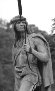 During the summer of 1763, Ottawa Chief Pontiac led raids on key British forts in the Great Lakes region. Shawnee Chief Keigh-tugh-qua, also known as Cornstalk, led similar raids on western Virginia settlements. The uprisings ended on August 6, 1763 when British forces, under the command of Colonel Henry Bouquet, defeated Delaware and Shawnee forces at Bushy Run in western Pennsylvania.
In 1768, the Iroquois Confederacy (often called the Six Nations) and the Cherokee signed the Treaty of Hard Labour and the Treaty of Fort Stanwix, relinquishing their claims on the territory between the Ohio River and the Alleghenies to the British.
In April 1774, the Yellow Creek Massacre took place near Wheeling. Among the dead were Mingo Chief Logan’s brother and pregnant sister. Violence then escalated into Lord Dunmore’s War.
On October 10, 1774, Colonel Andrew Lewis and approximately 800 men defeated 1,200 Indian warriors led by Shawnee Chief Cornstalk at the Battle of Point Pleasant, ending Lord Dunmore’s War.
The Mingo and Shawnee allied with the British during the American Revolutionary War (1776-1783). One of the more notable battles occurred in 1777 when a war party of 350 Wyandot, Shawnee, and Mingo warriors, armed by the British, attacked Fort Henry, near present-day Wheeling. Nearly half of the Americans manning the fort were killed in the three-day assault. Following the war, the Mingo and Shawnee, once again allied with the losing side, returned to their homes in Ohio. As the number of settlers in the region grew, both the Mingo and the Shawnee move further inland, leaving western Virginia to the white settlers.
RANDOLPH COUNTY’S EUROPEAN PIONEERS AND SETTLERS
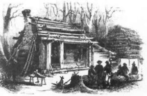 David Tygart (or Taggart) and Robert Files (or Foyle) were the first settlers in present-day Randolph County. They arrived in 1753 (or 1754). Files built his cabin near Beverly and Tygart’s cabin was constructed two miles to the north. The Tygart River and Valley are named in honor of David Tygart and Files Creek is named for Robert Files. That winter, Indians attacked the Files’ cabin and killed him, his wife, and five of his six children. One of his sons was not in the cabin at the time of the attack and escaped. He ran to Tygart’s cabin to warn him of the Indians’ presence. They then left the county for good, moving east into Pendleton County. Eighteen years passed before the next settlers arrived in Randolph County. In 1772, several families moved to the area, including the Hadden, Conley, Whiteman, Warwick, Nelson, Westfall, Riffle, and Stalnaker families.
IMPORTANT EVENTS DURING THE 1700s AND 1800s
Two small forts were constructed in present-day Randolph County during Lord Dunmore’s War in 1774. Fort Westfall was constructed at Beverly and Fort Currence near Huttonsville. The area’s settlers gathered in the forts whenever Indians were known to be in the area. Isolated incidents between the settlers and Indians continued for many years. The bloodiest incidents occurred in April and May 1791 when an Indian raiding party killed about a dozen settlers in the county. Among those killed were Joseph Kinnan and three of his five children. They were killed on May 11, 1791. His wife was taken captive, and was not released until the Indians’ defeat at the Battle of Fallen Timbers in 1794. A few days after the Kinnans were killed, the Indian raiding party killed Frank Riffle and William Currence. It is believed that they were the last settlers killed by Indians in Randolph County.
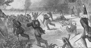 Most of Randolph County’s residents sided with the Confederacy during the Civil War.
On June 3, 1861, about 1,000 Confederate troops commanded by Colonel George Porterfield were defeated by about 1,900 Union troops commanded by Colonel Benjamin F. Kelley at the Battle of Philippi. That battle is considered by many the first land battle of the Civil War. Porterfield retreated to Huttonsville where he was met and relieved of his command by General Robert Selden Garnett. General Garnett then merged his 5,000 Confederate troops with the 1,000 led by Porterfield, creating an army of about 6,000 troops. General Garnett then established several defensive positions throughout the Beverly-Huttonsville area. He was especially interested in defending a strategic mountain pass on the Staunton-Parkersburg Turnpike. On June 22, 1861, 20,000 Union troops, commanded by General George Brinton McClellan crossed the Ohio River by Parkersburg and used the B & O Railroad to reach Grafton the next day. They then marched to meet General Garnett’s forces. The two forces then maneuvered for position for several weeks before finally meeting in battle on July 11, 1861 at Rich Mountain, just a few miles west of Beverly. The Confederate forces were defeated and forced to withdraw from the area. The victory was instrumental in General McClellan’s later being promoted to commander of the Army of the Potomac.
THE RANDOLPH COUNTY SEAT
The act creating Randolph County provided that the first meeting of the county court was to take place at Benjamin Wilson’s home in Tygart’s Valley, about three miles south of present-day Beverly. The meeting took place on May 28, 1787. Jacob Westfall, Salathiel Goff, Patrick Hamilton, John Wilson, Cornelius Bogard, John Jackson, George Westfall, Henry Runyan, John Haddan and Jonathan Parsons were the Justices of the Peace, with Salathiel Goff serving as President of the Court. Jacob Westfall was county’s first sheriff, John Wilson was the county’s first clerk, William McCleary was the county’s first prosecuting attorney, and Edward Jackson was the county’s first surveyor. John Haddan, John Jackson, and Cornelius Bogard shared the county assessor’s duties.
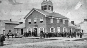 It was decided at the first meeting of the county court to build a courthouse on an acre of land donated by James Westfall. Westfall’s property was located in present-day Beverly. Oral tradition suggests that several citizens from Leading Creek attended the first meeting and requested that the courthouse be constructed there. However, they only offered to donate land for the courthouse, whereas James Westfall also offered to provide the timber for the courthouse’s construction.
Beverly was originally known as Edmundton, honoring Edmund Randolph. In June 1787, James Westfall asked the county court for permission to lay out a town on his property. The town was renamed Beverly, honoring Governor Randolph’s mother, by the Virginia General Assembly when it chartered the town on December 16, 1790.
Elkins, named for U.S. Senator Stephen Benton Elkins, a railroad magnate, lumber king, and wealthy banker, became the county seat in 1900, following a three year battle with Beverly. At one point during the dispute over which town should serve as the county seat, a special train was formed at Elkins to mount an attack on Beverly. The attack was averted at the last moment, but only after the Elkins’ residents were assured that the county seat would be moved to Elkins.
References
Bosworth, Albert Squire. 1916. A History of Randolph County, West Virginia. Elkins, WV: no publisher.
Maxwell, Hu. 1898. The History of Randolph County, West Virginia. Morgantown, WV: The Acme Publishing Company.
Author
Dr. Robert Jay Dilger, Director, Institute for Public Affairs and Professor of Political Science, West Virginia University.
